
|
Norsk side skogkartlegging
|
|
Forest mapping single trees |
TerraNor developed a complete and automatic solution for forest mapping based on eCognition. With use of high resolution images with RGB+IR we can detect all single trees in the forest, define species, height of each tree and crown size. With this info we can find DbH for each single tree in the forest.
Read the document and be convinced.
|
|
|
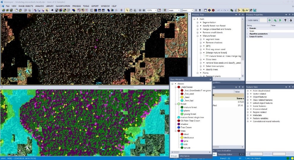
Single tree classification.
|
|
|
Klassifisere enkelt trær - norsk
|
|
|
|
|
|
|
Mapping
Forest health and
Bark Beetles
Ips Typographus |
Forest mapping of sick trees are important. This document shows how we used satellite GeoEye and airborne camera Leica ADS 80 to detect trees killed by Ips Typographus / bark beetle. Click the image to read the article. |
|
|
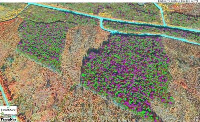
Detect dead and affected trees with ADS 80 sensor from Leica
|
|
|
The short version
|
|
|
|
|
Mapping plants and deciduous with eCognition |
Counting plants have always been a challenge in remote sensing. In this project document, we show you how we used eCognition to count plants with use of lidar DSM and DTM data. As a bonus we added analysis of coniferous and deciduous trees and terrain analysis for field transport of timber. |
|
|
 |
|
|
Mapping plants and deciduous with eCognition_eng.pdf
|
|
|
Kartlegging planter og løvskog med eCognition norsk.pdf
|
|
|
|
|
|