|


TerraNor remote sensing user Conference 2020 at Ås
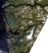
This year's conference was based on the project that University in Bergen (UiB) Department of Geography, PCI Geomatics and TerraNor did for Norwegian Environmental Agency in 2019. We analysed lidar data, GIS data, AR5 data, Sentinel 2, Sentinel 1 and WorldView 2 data for Hordaland (Vestland) and Trøndelag counties. Left Click on the images to open each speech. Right Click to download.
Dr. Solveig Havstad Winsvold, Norwegian Space Agency (Norsk Romsenter)
.
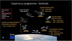
Sentinel 2 project and production of mosaic in NMA, Torgeir Ferdinand Klingenberg.
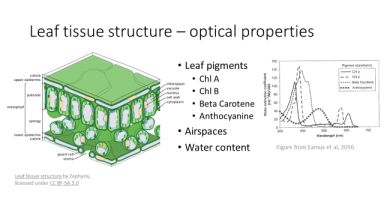
Optical properties of vegetation and VIs, Dr. Gidske Andersen UiB, Department of Geography
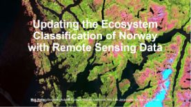
Updating the Ecosystem Classification of Norway with Remote Sensing Data, scientist Max Koller UiB, Department of Geography
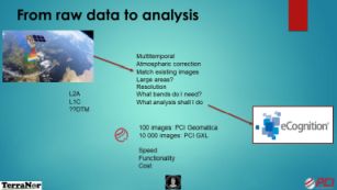
Preprocessing images from Satellite in GXL. Methodology for analysis in eCognition: threshold, machine learning, filtering and Deep Learning /CNN. CTO in TerraNor, Nils Erik Jørgensen.
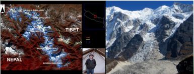
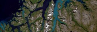
Glacial and Peri-glacial monitoring with Remote Sensing, Dr. Benjamin Aubrey Robson, UiB, Department of Geography.
News in eCognition, Deep Learning/CNN. Keith Peterson, product manager eCognition team, Trimble. - to be added.
User meeting 2020 video
|